Understanding Flood Zones: FEMA Maps Explained
A flood zone map may be the single most important document affecting your home's insurance costs, mortgage requirements, and resale value — yet most homeowners have never read one. FEMA's Flood Insurance Rate Maps (FIRMs) divide the entire United States into flood risk zones, each with a specific designation that determines whether you're required to carry flood insurance and how much you'll pay. This guide explains exactly what each designation means and what it means for you.
FEMA produces and maintains FIRMs through the National Flood Insurance Program (NFIP), which provides flood coverage to over 5 million policyholders across the country. The maps are updated continuously as new engineering studies, topographic surveys, and climate data become available. Understanding what you're looking at can save you thousands per year — or alert you to risks you didn't know existed.
What Is a FEMA Flood Zone Map?
A Flood Insurance Rate Map (FIRM) is an official government document showing the boundaries of Special Flood Hazard Areas (SFHAs), base flood elevations (BFEs), and risk zone designations for a given community. The maps are used by lenders, insurance agents, local governments, and homeowners to assess flood risk and set insurance premiums.
Each map panel covers a geographic area and uses color-coded zones with letter designations to indicate relative flood risk. The most important line on any FIRM is the SFHA boundary — the dividing line between high-risk zones (where federal flood insurance is mandatory for federally-backed mortgages) and lower-risk zones.
You can access your current FIRM at FEMA's Flood Map Service Center (msc.fema.gov). Enter your address to view the current effective map for your area. For a faster check, use our free Flood Risk Assessment to see your zone instantly along with actionable guidance.
The Major Flood Zone Designations
Zone A — High-Risk, No Base Flood Elevation
Zone A is the most common high-risk designation. It identifies areas with a 1% annual chance of flooding — statistically called the "100-year flood" — but does not include a specific Base Flood Elevation. This typically means the area hasn't received a detailed engineering study. Flood insurance is mandatory for federally-backed mortgages in Zone A, and premiums can be significant because without a BFE, insurers and policyholders can't precisely measure the gap between ground level and expected flood level.
Subcategories of Zone A include:
- A1–A30 — Older numbered zones from pre-1986 FIRMs, equivalent to modern AE zones but lacking updated BFE data
- AH — Areas with shallow flooding (1–3 feet deep) typically caused by ponding; BFE is shown as a depth
- AO — Sheet flow flooding on sloping terrain; depth is 1–3 feet with a defined average velocity
Zone AE — High-Risk with Detailed Study
Zone AE is the highest-risk designation you're likely to encounter for inland properties. Like Zone A, it carries a 1% annual flood chance. Unlike Zone A, a detailed hydrological and hydraulic engineering study has established specific Base Flood Elevations for the area. This is critically important because your BFE determines your flood insurance premium and whether your lowest floor is above or below the flood line.
If you're in Zone AE, your Elevation Certificate will show the difference between your lowest floor elevation and the BFE. A home with its lowest floor 2 feet above BFE pays dramatically less than one at or below BFE. This gap — called freeboard — is the single largest variable in your NFIP premium. See our guide to Understanding Flood Zones for detailed premium calculations by elevation.
Zone VE and Zone V — Coastal High-Velocity
Zone VE (and older Zone V) designations apply to coastal areas subject to the 1% annual flood chance plus wave action. The "V" stands for velocity — these are the most dangerous flood zones because water isn't just deep, it's moving fast and carrying debris. Zone VE always includes a BFE. Homes in Zone VE require foundation engineering that accounts for wave forces, and insurance premiums are substantially higher than AE zones at equivalent elevations.
If you're buying property in Zone VE, factor in: mandatory flood insurance, strict building codes requiring open foundation systems (pilings or columns), and higher construction costs for any improvements. The trade-off is typically the premium location — coastal views often command high real estate premiums despite the risk.
Zone X — Moderate to Low Risk
Zone X is where most U.S. homeowners live. It covers areas with between 0.2% and 1% annual flood chance (the "500-year floodplain") and areas with less than 0.2% chance or protected by levees. Zone X is subdivided:
- Zone X (shaded) — Moderate flood hazard, 0.2%–1% annual chance. Flood insurance is not mandatory but strongly recommended. FEMA data shows that 20–25% of NFIP claims come from properties outside high-risk zones.
- Zone X (unshaded) — Minimal flood hazard. Less than 0.2% annual chance, or behind an accredited levee. This does not mean zero risk — heavy rainfall can cause flooding anywhere.
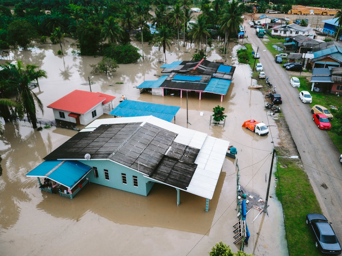
A critical reality: being in Zone X does not mean you're safe from flooding. It means your risk is lower than a high-risk zone. Heavy rainfall events, failed drainage systems, and rapid urban development all cause flooding in Zone X areas regularly. FEMA's own data shows substantial claims from outside SFHAs every year.
Zone D — Undetermined Risk
Zone D appears in areas where FEMA hasn't conducted a flood study. Flood hazard is possible but unknown. Flood insurance is available but not required. If you're buying property in Zone D, treat it as potentially high-risk until a proper study establishes the actual risk level.
How to Read Your FIRM Panel
When you pull up your FIRM at FEMA's map service center, you'll see:
- Zone boundaries — Colored areas with letter designations. Cross-hatching typically marks regulatory floodways (the channel needed to carry flood flows without raising BFE).
- BFE lines — Contour lines marked in feet above sea level (or NAVD 88 datum). Your elevation certificate will compare your structure to these lines.
- Panel number and effective date — Shown in the map legend. This tells you which version of the map is currently in effect. Make sure you're looking at the current effective FIRM, not a historical version.
- FIRM panel index — A broader map showing panel layout for the entire community. Use this to find the correct panel number for your address.
How Flood Zones Affect Mortgage and Insurance Requirements
If your home is in Zone A, AE, AH, AO, VE, or V, and you have a federally-backed mortgage (FHA, Fannie Mae, Freddie Mac), flood insurance is legally required. Your lender will verify zone status at closing and annually. If you drop flood insurance on a federally-backed loan in a high-risk zone, your lender can force-place a policy — typically at two to three times the cost of a policy you'd buy yourself.
Even without a mandate, flood insurance makes financial sense in Zone X. The NFIP charges moderate-risk Zone X rates that are substantially lower than high-risk zone premiums. Consider that the average NFIP claim payout is over $52,000 — and standard homeowners insurance doesn't cover a single dollar of flood damage.
Use our Cost Calculator to estimate your flood insurance premium based on zone, elevation, and coverage level before you commit to a property or policy.
When Flood Maps Change: Letters of Map Amendment (LOMA)
FEMA maps are updated, but properties are sometimes incorrectly placed in high-risk zones due to outdated topographic data. If your home sits physically above the BFE but is mapped in Zone A or AE, you may be eligible for a Letter of Map Amendment (LOMA). A LOMA is an official FEMA letter removing your structure from the SFHA — eliminating the mandatory insurance requirement and potentially qualifying you for a full premium refund for prior years.
The process requires a licensed land surveyor to document your lowest adjacent grade elevation. If it's above the BFE, FEMA typically approves the amendment within 60 days. The cost of a survey ($300–700) is almost always recovered in the first year of insurance savings. Your lender is legally required to remove the flood insurance mandate once you receive the LOMA.
Flood Zone Changes and Your Home's Value
Being remapped from Zone X into Zone AE can reduce property values by 2–4% according to real estate research, largely driven by the added insurance cost. Being remapped out of a high-risk zone can have the opposite effect. If your area is scheduled for a FIRM update, engage with your local floodplain administrator — you may have opportunities to provide input on the study methodology or request a LOMA preemptively based on elevation data.
A professional Elevation Certificate, prepared by a licensed surveyor, is the foundational document for understanding your precise relationship to flood risk. It shows your lowest floor elevation, enclosure elevations, and adjacent grades relative to BFE — everything needed to accurately rate your flood insurance, apply for a LOMA, or demonstrate mitigation improvements. Request one from your local government or hire a licensed surveyor directly.
Beyond the Map: The Limits of Flood Zone Designations
FEMA maps are engineering tools, not guarantees. They represent the best available data at the time of their last update — which may be years or decades old. Climate change is altering rainfall intensity and storm surge patterns faster than maps are being updated. Urban development changes runoff patterns. Levees that once protected Zone X areas can fail.
The practical implication: treat your FIRM designation as a starting point, not a ceiling on your risk. Use our free Flood Risk Assessment to layer additional risk signals — including First Street Foundation data, drainage capacity, and historical flood claims — onto your FEMA zone for a more complete picture.
For actionable flood protection strategies based on your zone, see our complete guide to How to Protect Your Home from Flooding and browse flood protection products rated for your risk level.